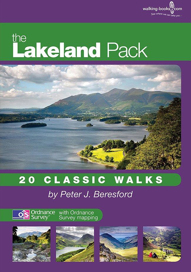
'The Lakeland Pack'
The Lakeland Pack from Walking Books is a handy-to-carry, easy-to-use pack with info on 20 memorable walks in the Lakes area, of varying distances and difficulty.
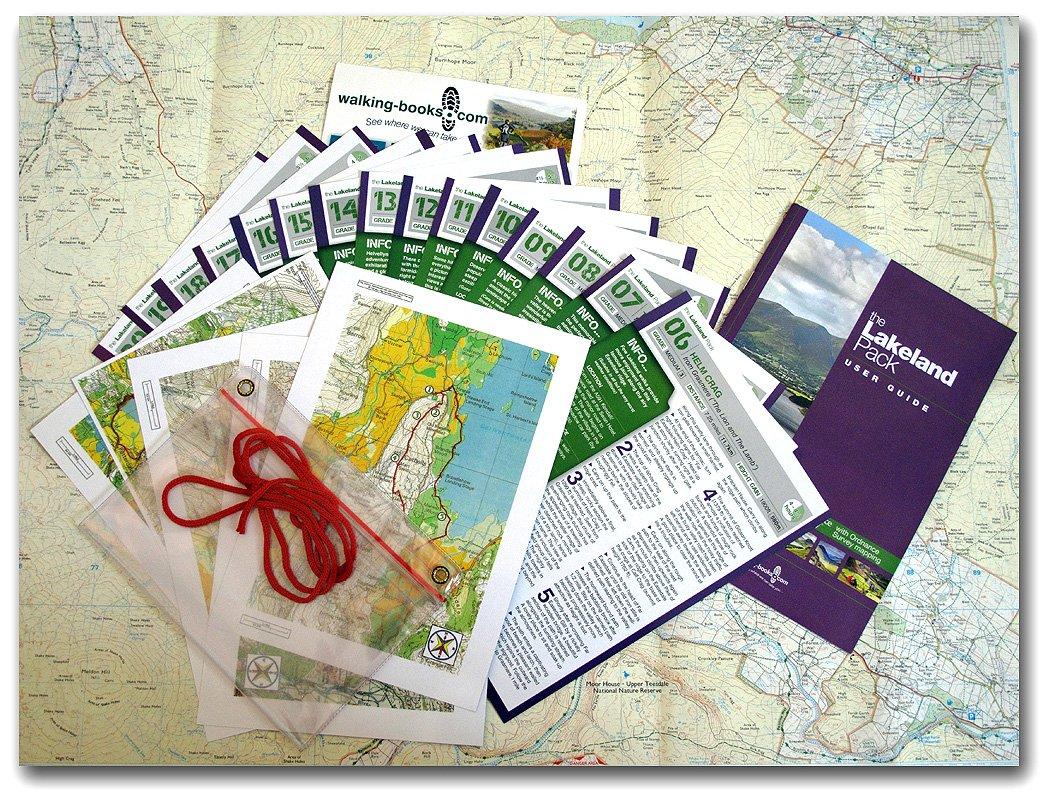
Each walk is on user-friendly and durable A5 laminated cards, which include Ordnance Survey mapping, concise clear directions, and any notable places of interest. A mapcase is also provided.
Walks covered in this set:
-
Round Loughrigg Fell from Ambleside, inspiring, easy 7 mile walk
- Ullswater Shore Walk; Howtown to Glenridding, easy 6.5 mile walk
- Cat Bells from Skelgill near Portinscale, easy-medium 4.75 mile walk
- Causey Pike & Sail from Stoneycroft near Stair, medium 5.25 mile walk
- Harter Fell from Eskdale, medium 5 miles walk
- Helm Crag from Grasmere ("The Lion and The Lamb"), medium 7.25 mile walk
- The Old Man of Coniston from Coniston Village, medium 6.75 mile walk
- Haystacks & Fleetwith Pike from Gatesgarth, medium/difficult 5 mile walk
- High Street and Harter Fell from Mardale, medium/difficult 7.25 miles walk
- The Langdale Pikes from the new Dungeon Ghyll Hotel, medium/difficult 4.5 mile walk
- Crinkle Crags from the old Dungeon Ghyll Hotel, difficult 7.25 miles walk
- Great Gable from Honister Pass, difficult 6 mile walk
- Helvellyn from Glenridding, difficult 7.75 mile walk
- The High Stile Range from Buttermere, difficult 7.25 mile walk
- The Kentmere Fells from Kentmere Village, difficult 10.75 mile walk
- The Newlands Horseshoe (Dale Head) from Little Town, difficult 8.5 mile walk
- St Sunday Crag & Fairfield from Patterdale, difficult 9.5 mile walk
- Blencathra from Scales (near Threlkeld), very difficult 5.5 mile walk
- The Mosedale Horseshoe (Pillar) from Wasdale Head, very difficult 8 mile walk
-
Scafell Pike from Seathwaite, very difficult 9 mile walk
More Images
'The Lakeland Pack'
The Lakeland Pack from Walking Books is a handy-to-carry, easy-to-use pack with info on 20 memorable walks in the Lakes area, of varying distances and difficulty.
Each walk is on user-friendly and durable A5 laminated cards, which include Ordnance Survey mapping, concise clear directions, and any notable places of interest. A mapcase is also provided.
Walks covered in this set:
-
Round Loughrigg Fell from Ambleside, inspiring, easy 7 mile walk
- Ullswater Shore Walk; Howtown to Glenridding, easy 6.5 mile walk
- Cat Bells from Skelgill near Portinscale, easy-medium 4.75 mile walk
- Causey Pike & Sail from Stoneycroft near Stair, medium 5.25 mile walk
- Harter Fell from Eskdale, medium 5 miles walk
- Helm Crag from Grasmere ("The Lion and The Lamb"), medium 7.25 mile walk
- The Old Man of Coniston from Coniston Village, medium 6.75 mile walk
- Haystacks & Fleetwith Pike from Gatesgarth, medium/difficult 5 mile walk
- High Street and Harter Fell from Mardale, medium/difficult 7.25 miles walk
- The Langdale Pikes from the new Dungeon Ghyll Hotel, medium/difficult 4.5 mile walk
- Crinkle Crags from the old Dungeon Ghyll Hotel, difficult 7.25 miles walk
- Great Gable from Honister Pass, difficult 6 mile walk
- Helvellyn from Glenridding, difficult 7.75 mile walk
- The High Stile Range from Buttermere, difficult 7.25 mile walk
- The Kentmere Fells from Kentmere Village, difficult 10.75 mile walk
- The Newlands Horseshoe (Dale Head) from Little Town, difficult 8.5 mile walk
- St Sunday Crag & Fairfield from Patterdale, difficult 9.5 mile walk
- Blencathra from Scales (near Threlkeld), very difficult 5.5 mile walk
- The Mosedale Horseshoe (Pillar) from Wasdale Head, very difficult 8 mile walk
-
Scafell Pike from Seathwaite, very difficult 9 mile walk
Product Information
Product Information
Shipping & Returns
Shipping & Returns
Description
The Lakeland Pack from Walking Books is a handy-to-carry, easy-to-use pack with info on 20 memorable walks in the Lakes area, of varying distances and difficulty.
Each walk is on user-friendly and durable A5 laminated cards, which include Ordnance Survey mapping, concise clear directions, and any notable places of interest. A mapcase is also provided.
Walks covered in this set:
-
Round Loughrigg Fell from Ambleside, inspiring, easy 7 mile walk
- Ullswater Shore Walk; Howtown to Glenridding, easy 6.5 mile walk
- Cat Bells from Skelgill near Portinscale, easy-medium 4.75 mile walk
- Causey Pike & Sail from Stoneycroft near Stair, medium 5.25 mile walk
- Harter Fell from Eskdale, medium 5 miles walk
- Helm Crag from Grasmere ("The Lion and The Lamb"), medium 7.25 mile walk
- The Old Man of Coniston from Coniston Village, medium 6.75 mile walk
- Haystacks & Fleetwith Pike from Gatesgarth, medium/difficult 5 mile walk
- High Street and Harter Fell from Mardale, medium/difficult 7.25 miles walk
- The Langdale Pikes from the new Dungeon Ghyll Hotel, medium/difficult 4.5 mile walk
- Crinkle Crags from the old Dungeon Ghyll Hotel, difficult 7.25 miles walk
- Great Gable from Honister Pass, difficult 6 mile walk
- Helvellyn from Glenridding, difficult 7.75 mile walk
- The High Stile Range from Buttermere, difficult 7.25 mile walk
- The Kentmere Fells from Kentmere Village, difficult 10.75 mile walk
- The Newlands Horseshoe (Dale Head) from Little Town, difficult 8.5 mile walk
- St Sunday Crag & Fairfield from Patterdale, difficult 9.5 mile walk
- Blencathra from Scales (near Threlkeld), very difficult 5.5 mile walk
- The Mosedale Horseshoe (Pillar) from Wasdale Head, very difficult 8 mile walk
-
Scafell Pike from Seathwaite, very difficult 9 mile walk