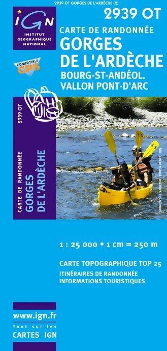
'TOP 25' Series: 2939 OT Gorges de l'Ardeche/ Bour
IGN 'Top 25' series maps are the equivalent scale to the UK's Ordnance Survey's Explorer range, and cover areas of particular tourist interest including the Alps, Pyrenees, Cevannes, Vosges, Provence, Atlantic and Mediterranean coasts.
The IGN Top 25 Maps feature contours at 5m (10m in mountainous areas with additional hill shading), highlights of local footpaths, long-distance GR routes and, where appropriate, ski routes.
Other tourist information includes campsites, equestrian and canoeing centres, huts, mountain refuges, historic and notable sites, etc.
Coverage; Vallon-Pont-d'Arc, Bourg-st-Andeol, Barjac
- Scale 1/25,000 (1cm = 250m)
- ISBN 3282113841030
- GPS compatible
- Weight: 0.095kg
- 11cm x 24cm
- Map legend in French and English
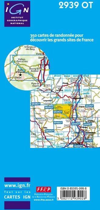
- Each TOP25 map covers an area of approximately 28km x 21km (17 x 13 miles)
More Images
'TOP 25' Series: 2939 OT Gorges de l'Ardeche/ Bour
IGN 'Top 25' series maps are the equivalent scale to the UK's Ordnance Survey's Explorer range, and cover areas of particular tourist interest including the Alps, Pyrenees, Cevannes, Vosges, Provence, Atlantic and Mediterranean coasts.
The IGN Top 25 Maps feature contours at 5m (10m in mountainous areas with additional hill shading), highlights of local footpaths, long-distance GR routes and, where appropriate, ski routes.
Other tourist information includes campsites, equestrian and canoeing centres, huts, mountain refuges, historic and notable sites, etc.
Coverage; Vallon-Pont-d'Arc, Bourg-st-Andeol, Barjac
- Scale 1/25,000 (1cm = 250m)
- ISBN 3282113841030
- GPS compatible
- Weight: 0.095kg
- 11cm x 24cm
- Map legend in French and English
- Each TOP25 map covers an area of approximately 28km x 21km (17 x 13 miles)
Product Information
Product Information
Shipping & Returns
Shipping & Returns
Description
IGN 'Top 25' series maps are the equivalent scale to the UK's Ordnance Survey's Explorer range, and cover areas of particular tourist interest including the Alps, Pyrenees, Cevannes, Vosges, Provence, Atlantic and Mediterranean coasts.
The IGN Top 25 Maps feature contours at 5m (10m in mountainous areas with additional hill shading), highlights of local footpaths, long-distance GR routes and, where appropriate, ski routes.
Other tourist information includes campsites, equestrian and canoeing centres, huts, mountain refuges, historic and notable sites, etc.
Coverage; Vallon-Pont-d'Arc, Bourg-st-Andeol, Barjac
- Scale 1/25,000 (1cm = 250m)
- ISBN 3282113841030
- GPS compatible
- Weight: 0.095kg
- 11cm x 24cm
- Map legend in French and English
- Each TOP25 map covers an area of approximately 28km x 21km (17 x 13 miles)